Condition
As
previously mentioned in the Atmosphere section of this report,
weather conditions (heavy rainfall events, cyclones, and droughts)
create various pressures for local ecosystems and human efforts
to conserve biodiversity.
These
conditions impact on different types of ecosystems in different
ways. Because Townsville is situated in an area where the northern
and southern tropics of east coast Australia meet, the city has
a unique and large variety of local ecosystems with four distinct
botanical bioregions (Northern Brigalow Townsville Plains Province;
Wet Tropics; Einsleigh Uplands; and Central Queensland Coast).

Click
image to see QLD EPA Regional Ecosystems
Other
important biological and geographic attributes of the area include
the proximity of Magnetic Island and World Heritage Great Barrier
Reef, access to the Wet Tropics (Paluma and Mt. Elliot), Wetlands
such as the Cromarty, Town Common, Ross Dam, South Bank, Serpentine
Lagoon and other smaller wetlands. Townsville is the place where
the tropical savanna meets the coast (Muntalunga/Sisters/Mt. Stuart,
the Vine Thickets /Monsoon Scrub of Many Peaks, Mt. Stuart, Magnetic
Island/Harvey Range Mt. Flagstone/Black Mountain, and Cape Cleveland
and the mangrove/chenier grasslands and seagrass wetlands, South
Bank) - see TCC Natural Assets Database and the Dry Tropics Biodiversity
Group (DTBG) local
native plant "Hot Spots".
 Click
image to visit CRC Savanna Explorer
Click
image to visit CRC Savanna Explorer
The
coastal region surrounding Townsville (Lucinda-Mackay Marine Bioregion)
is characterised by complex high-island groups, sandy-mud substrates,
mangroves with a lower level of seaside animal diversity than areas
further north. There is a large tidal range in the south of the
area. Animal and plant life consists of 20 mangrove species, 25
tree and understorey species, 8 saltmarsh species, with low closed-open
forest communities along sheltered coasts and rivers. There are
more than 70 types of corals.
Source:
IMCRA Technical Group (1998)
The
condition of local ecosystems can be assessed with a number of
indicators, including the;
- number
of species of vertebrates, invertebrates, vascular plants, non-vascular
plants, micro-organisms and fungi present within the local area
(CSIRO Fauna Studies, Queensland Herbarium; and Defence Lands);
-
number of endemic and common species and vegetation communities
(Regional Ecosystems) of the Townsville region;
-
conservation status of species (Rare, Threatened, Endangered and
Extinct Flora and Fauna Species);
-
number of subspecies (useful for showing genetic diversity within
a species); and
-
area of natural vegetation cover, including numbers and size of
fragments of remnant vegetation (habitats).

Click
image to enlarge - Dragonfly - Tropical savanna fauna
Coastal Tropics of Townsville and Fauna
Townsvilles
rich biodiversity provides a habitat for a wide range of migratory
species. It also includes many animal species either only found
in this region (otherwise known as endemic) and or closely related
to other species in surrounding regions. For example, the occurrence
of endemic species on Mount Elliot (leaf-tailed gecko and a small
frog) which have close affinities with species restricted to the
Wet Tropics and rainforests in the Eungella-Proserpine area.
Several
bird species, which are common of found in Townsville region, reach
the southernmost limit of their range along the coast between Townsville
and Mackay/Broad Sound areas. These include:
- White-gaped
honeyeater
-
Brown backed honeyeater
-
Yellow honeyeater
-
Little Kingfisher
-
Orange footed scrub fowl
-
Crimson finch
Other
species which migrate from Indonesia and Papua New Guinea, such
as the Pied Imperial Pigeon and Buff-Breasted paradise kingfisher
do not travel further south than the Mackay region.
Woodland
and wetland birdlife are also characteristic of Townsville suburbs.
Birds often seen include; Yellow Honeyeaters, Spangled Drongos;
Sunbirds, Brahminy Kites, Spoonbills and Ibis.
The
significance of the rainforests around Townsville is reflected in
some scientific views that the Townsville lowlands and Mount Elliott
should be considered as part of the Wet Tropics. One example is
a review of vertebrate distributions and patterns of diversity within
the Wet Tropics bioregion (Williams et al, 1996). They reiterated
that the Elliot uplands should be included in any analysis of the
Wet Tropics fauna. Three species found locally are only found in
the Wet Tropic (Nix Switzer, 1991) and reach the southern-most limit
of their range in the Townsville area namely;
-
Tooth billed catbird (Mt. Elliot)
-
Golden Bowerbird (Paluma)
-
Limbless snake-tooth skink (Mt. Elliot)
Note:
All above sourced from Planning to Protect Biodiversity (Environment
North 2002) and local knowledge
Other
endemic fauna includes:
- Mt.
Elliot Spiny Crayfish (Euastacus bindal)
- Mt.
Elliot Nursery Frog (Cophixalus mcdonaldi)
Leaf
tailed Gecko (Phyllurus amnicola) a newly described species
which is found in dense forest on the upper slopes of Mt. Elliot
(Couper et al., 2000).
Saxicoline
Sunskink (Lamproholis mirabilis) endemic to Mt. Elliot,
Cape Cleveland, Mt. Stuart and Magnetic Island only.
Mt.
Elliot is also known to have a number of endemic insect species
(Graham 1991, cited in Williams et al.1993).
Snakes of Townsville
Townsville
has a variety of snakes including the following common snakes of
the area: Brown Tree Snake (see photo below); Common Tree Snake;
Keelback; Water Python; Spotted Python; Carpet Python; Death Adder;
Black Whip Snake; Northern Crowned Snake (rarely seen); Orange-Naped
Snake; Eastern Taipan (one of the world's most DANGEROUS snakes
and uncommon around Townsville); and Eastern Brown Snake (Townsville's
most common DANGEROUS snake and often mistaken for the Taipan).
Source: from TCC
Snake Poster 2000, produced by G.Calvert (Earthworks Environmental
Services).

Click
image to enlarge
Brown Tree Snake - private photo collection North Ward Resident
FOR ENQUIRIES REGARDING SNAKE IDENTIFICATION OR REMOVAL PLEASE
CONTACT QUEENSLAND PARKS & WILDLIFE SERVICE OFFICERS ON Tel:
4722 5388.
Bird and Animal Lists of Townsville
Wildlife Online Extract - Townsville Species List (180kb
.pdf)
At
a local scale bird and animal lists have been prepared by a range
of community groups for South Bank (Bird Observers), Ross Colony
(RIVER Group); Stuart Creek (Earthworks); Blakeys Crossing (Bird
Observers Club). This community-based research is invaluable and
provides excellent data for consideration in biodiversity conservation
planning in Townsville. The RIVER Group has performed daily bird
counts for 1997-1999 (The
RIVER Report - Birds section).
RIVERs
research included fish surveys of the lower Ross River estuary.
Australian Centre for Tropical Freshwater Research (ACTFR) surveys
of fish biodiversity in the Lakes-Ross Creek estuarine system have
been undertaken in 1990-3, 1999 and due to a fish kill in 2002.
Fish species are described in the report and include some freshwater
fish but mainly consist of saltwater fish.
Results
are shown below:
|
Location
|
1989
|
1990-3
|
1999
|
2002
|
| Lakes
1 |
11
|
25
spp |
10
spp |
19
spp (recorded as result
of fish kill) |
| Lakes
2 |
Not
constructed |
Not
constructed |
18
|
not
known |
| Upper
Ross Ck |
20
|
34
|
34
|
not
known |
Source:
South Townsville Stormwater Drainage Fish Survey Report
No.99.30 ACTFR 1999
While
the surveys are not conclusive, they do suggest that the biodiversity
in the Ross Creek system is relatively healthy. The
RIVER Report is included below, due to its value and community input
of quantitative data on the biological resources of the Ross River
estuary. The RIVER Report should be read in conjunction with the
report on marine matters for site specific Ross Island and Ibis/Flying
Fox Colony.
Click
to see the Rivers Report.

Click
image to enlarge - Salt water crocodile
Another
useful indicator of ecosystem health is the prevalence of frogs.
Sinclair Knight Merz consultants (SKM) have compiled a list of frogs
(see below) considered likely to occur in Louisa Creek (compiled
from Hero et al. 1997 and from discussions with JCU herpetologist
Steve Richards).
| FAMILY
|
SPECIES
|
COMMON
NAME |
| Buforidae
|
Bufo
marinus |
Cane
Toad |
| Hylidae
|
Litoria
bicolor |
Northern
Sedgefrog |
| |
Litoria
caerulea |
Green
treefrog |
|
Litoria
fallax |
Eastern
sedgefrog |
| |
Litoria
gracilenta |
Graceful
treefrog |
|
Litoria
inermis |
Bumpy
rocketfrog |
|
Litoria
leseuri |
Stony-creek
frog |
|
Litoria
nasuta |
Striped
rocketfrog |
|
Litoria
rothi |
Red-eyed
frog |
|
Litoria
rubella |
Naked
treefrog |
| Myobatrachidae
|
Crinia
deserticola |
Chirping
Froglet |
|
Limnodynastes
convexiusculus |
Marbled
frog |
| |
Limnodynastes
ornatus |
Ornate burrowing-frog |
|
Limnodynastes
tasmaniensis |
Spotted
Marshfrog |
|
Notaden
melanoscaphus |
Northern
Spadefoot |
|
Uperoleia
lithomoda |
Stonemason
Gungan |
|
Uperoleia
mimula |
Torres
Gungan |
The
majority of these frog species prefer swampy, flooded wetlands rather
than stream channels. While the above list is useful as a guide
for biodiversity data collection in future, the extent of the distribution
and prevalence of these species in Townsville rivers is not currently
known with certainty.
Tropical
butterflies are particulartly diverse in Townsville with 50% of
the 103 named Australian species occuring within 100 kilometers
of the Townsville Post Office, (P.Valentine,
1999).
Even
within the city proper, 144 species are known to occur. While all
[butterfly] families are present in Townsville, the large papilionids
(birdwings, swallowtails) are extremely well represented. For more
information on butterflies and butterfly attracting plants in Townsville
see attached case study on Gardening
for Butterflies (Australian Plants Online No.14 June 1999
SGAP article by P. Valentine (Lecturer,
James Cook University).
Habitat Values
Habitat
quality has a big impact on the capacity of communities to protect
biodiversity. Habitat provides food, shelter and particular breeding
conditions for all wildlife. The better the habitat quality, the
more options for biodiversity protection available to the local
community.
Within
ecosystems, habitats can be divided into three broad categories:
- Natural
Habitat - these areas retain the structural and compositional
integrity of their natural habitats. Some level of disturbance
associated with weeds, grazing, fire regime or past clearing may
be present but is not discernible on remotely sensed images;
- Disturbed
Habitat - these areas; retain natural habitat values but exhibit
some level of physical and ecological disturbance associated with
grazing, clearing, weed invasion, erosion, isolation or existing
land use i.e., rural residential areas. If not subject to further
disturbance pressure, disturbed habitats are often able to maintain
their condition, or may regenerate to natural habitat; and
- Transformed
and/or Degraded Habitat - these areas have been subject to
intensive land use or development that has completely transformed
the pre‑existing natural habitat. In most cases the transformed
habitat i.e., quarry, industrial, aquaculture, cleared and/or
eroded areas, represent a degradation of natural habitat values.
However, some transformed habitat areas i.e. dams, reservoirs,
urban gardens and grasslands created by clearing, provide natural
habitat value that in some instances e.g. Ross River Dam, can
have significant nature conservation value. Generally, transformed
habitat areas will not regenerate to a natural habitat condition
without some level of management input.
Within
the Townsville region, 63% of habitat falls within the category
natural , 24% is transformed and/or degraded habitat, and the
remaining 12% is disturbed habitat (TTSP Nature Conservation 1996).
This suggests that the vast majority of habitat in Townsville is
of a high quality either in natural condition or restorable to
such condition. Biodiversity Maps developed by TCC provide a clearer
picture of the condition of habitats in particular locations in
and around the city.
Click
to see all the Biodiversity Maps
Click
here for Overall
Biodiversity Map (TCC jurisdiction)
Click
here to See Marine and Intertidal
Habitat map

Click
image to enlarge - Pods of a deciduous native peanut
Terrestrial Vegetation
In
addition to its unique fauna, a significant part of habitat quality
is the diversity and prevalence of vegetation cover. Townsville
is home to more than 1,600 plant species. Information on the flora
of the region is available from;
· Queensland
Herbarium database
· Broad-scale
CSIRO vegetation mapping
· Queensland
Herbarium Regional Ecosystem Mapping
· Townsville
City Council commissioned local vegetation mapping
|
Plants
|
No.
of Species |
| Angiosperms
(Flowering plants) |
1,550
|
| Gymnosperms
(Conifers and cycads) |
3
|
| Pteridophytes
|
60
|
| Total
|
1,613
|
Source:
HERBRECS database from the Queensland Herbarium

Click
image to enlarge - Native croton in dry season
Endemic Flora
Not
many plant species are endemic to the Townsville area. Endemic flora
seem to be mainly associated with highland features and flora refuges
(Mt. Elliot, Mt. Stuart, and Magnetic Island). The following species
are endemic to Townsville:
- Babingontina
papillosa: a shrub which occurs only in Bowling Green Bay
National Park in two known populations at Mt. Elliot and Cape
Cleveland (Bean 1999).
- Eucalyptus
paedoglauca: (Mt. Stuart Ironbark) a eucalypt generally only
known from Mt. Stuart (Brooker Kleinig 1994)
- Croton
magneticus: a shrub which occurs on Magnetic Island and Mount
Stuart (note: another Croton - Croton arnhenicas is also
common on Magnetic Island; Many Peaks and lower slopes of Mt.
Elliot (AIMS turnoff).
- Grewia
graniticola: a shrub on Magnetic Island and Cape Cleveland
is considered a near endemic as it is found at only a couple of
locations close to Townsville (Gloucester Bay near Bowen and at
Mingela Bluff (Halford 1993).
Source:
Compiled from TCC Planning to Protect Biodiversity Environment North
2002
Though
not endemic some species once thought to be widespread across Northern
Australia are now uncommon to rare in the Townsville area (Albizia
canescens). Some considered this Albizia was a common open
woodland species of Townsville (occurring to coastal Central Queensland)
and following exploitation for cabinet timber and drought fodder
became uncommon (CSIRO pers. com.). This tree has been discovered
in a few places along Ross River in recent years but still remains
uncommon.
Other
flora species of interest when considering Townsvilles biodiversity
include:
- Livistonia
drudei a palm which is rare in Townsville and mainly occurs
north of the Bohle River, although it is recorded at Emmett Creek
and Magnetic Island (although status on MI is uncertain).
- Livistonia
decipens (weeping fan palm) occurring at its northern most
limit (distribution Townsville to Fraser Island) (J. Dow pers.
com.)
- Cassia
sp (Paluma Range) which is recorded for Magnetic Island
vine forest and Cape Cleveland in semi-closed forest on steep
rock slopes
- Aponogeton
queenslandicus a rare aquatic herb found in Townsville Common
freshwater swamp
- Terminalia
arenicola is recorded at a key research site and its type
locality occurs in Townsville. There are at least four other Terminalia
spp found in Townsville area (T.mulleri, catappa,
sericocarpa, melanocarpa). All species seem to be
found in distinct localities either strand vegetation (beach almond);
beach scrub (damson); riparian areas/semi-deciduous vine thicket
(sericocarpa); or in open woodland e.g. Castle Hill/Many Peaks
(melanocarpa).
- Archontophonenix
alexandrae (Alexandra Palm) which occurs on Mt Elliot along
upper Alligator Creek (often bent over in rock creek beds amongst
bottlebrush shrubs (Callistemon viminalis) as a result of heavy
floods). Also recorded for lower slopes of Mt. Elliot (Majors
Creek area and Cromarty-St Margaret Creek), Pinnacles, and in
Nelly Bay on Magnetic Island
- Musa
banksii (native banana) is recorded at another key research
site and type locality which is at its southern most limit on
Mt Elliot. It is also recorded for gullies near the Pinnacles
Range (C.Lokkers pers. com.).
Various
biodiversity maps prepared by TCC provide an indication of the location
and significance of different plant communities in the region.
Click
here for Plant
Communities of Conservation Significance Major Remnants coming.
Source:
Compiled from TCC Planning to Protect Biodiversity Environment North
2002 and local knowledge/pers com.

Click
image to enlarge - Native gardenia leaves and fruit
Regional Ecosystem Mapping
It
is important to appreciate that entire regional ecosystems are,
alongside individual species of plants and animals, a critical part
of biodiversity. So, the nature and prevalence and condition of
particular ecological communities are a important considerations
in understanding the State of the Environment as it relates to biodiversity.
Most of the regional ecosystems are within the Townsville Plains
Province of the Brigalow Belt (North) bioregion (80%). The remainder
are within the Einasleigh Uplands bioregion and outliers of the
Wet Tropics or Central Queensland Coast bioregions. The Queensland
Herbarium has mapped 55 regional ecosystems occurring within the
study area.
Of
these 55 Regional Ecosystems, at least;
- 3
are endemic to and only occur in the Townsville Plains Province,
- 11
are endemic to Townsville Plains and Bogie River Hills, and
- 10
are endemic to Townsville Plains and Marlborough Plains.
The
conservation status of each of these regional ecosystems is discussed
in the TCC report Planning to Protect Biodiversity (Environment
North 2002). The Regional Ecosystem Mapping has been evaluated for
vegetation clearance and biodiversity issues.

Click
image to enlarge - Colour and texture of a pandanus
EPA Conservation Significance Mapping
(Queensland
Herbarium) provides Regional Ecosystem (RE) Mapping as the primary
unit for State planning to conserve biodiversity. State conservation
status is based on a number of factors including;
· Remaining
extent of the regional ecosystem;
· Condition
of remaining examples; and
· Presence
of threatening processes
See
Map EPA
Conservation Significance (Queensland Herbarium)
The Queensland Governments
Vegetation Management Act 2000
(VMA
and associated mapping) provides a legislative framework for managing
and assessing clearing of freehold land. The mapping associated
with the VMA shows the extent of vegetation controlled by the Act
in different bioregions of the State.
Vegetation
mapping has also been completed at 1:25,000 scale (Skull, 1996)
and also more locally for Magnetic Island (Sandercoe 1990) and at
a micro scale for Nelly
Bay, Horseshoe
Bay and Rowes
Bay. Vegetation mapping has also been completed by the Townsville
based Environmental Management Section of the Australian Defence
Forces (ADF) for Mt Stuart.

Click
image to enlarge - Pink lilly lagoon at Horseshoe Bay, Magnetic
Island
Wetlands
Townsville
City has one RAMSAR listed wetland occurring within its boundaries
(Bowling Green
Bay NP) and three Wetlands of National Importance (Burdekin-Townsville
Coastal Aggregation, Ross River Reservoir, and Serpentine Lagoon).
Nationally
Important Wetlands:
| Wetland
Name |
Size
(km2) |
Wetland
Class |
Criteria
for inclusion |
| Burdekin-Townsville
Coastal Aggregation |
1,492
|
Marine
& Coastal, inland, human-made |
1,
2, 3, 4, 5, 6 |
| Includes
Bowling
Green Bay |
325 |
Marine
& Coastal, inland, human made |
1,
2, 3, 4, 5, 6 |
Ross
River
Reservoir |
28 |
Human-made
|
1,
2, 3, 4 |
Serpentine
Lagoon |
<
10 |
Inland
|
Not
available |
Source:
(Blackman et al, 1996, 1999) and for Serpentine Lagoon Blackman
G. (2001 pers. Com.)
Townsville
has a range of regional and locally significant wetlands which
have been identified by Lukacs (1996) and TTSP (Tait 1996). These
wetlands include Freshwater Swamps of Cape Cleveland to Cungulla;
Killymoon Creek below and above Bruce Highway; Picnic Bay to West
Point Mangroves and wetlands; Sachs Creek (Oak Valley), Majors
Creek; Reid River, and Ross River above and below weirs.
Local Wetland Types
Mapping
by Lukacs (1996) also identified the following wetland types (1:40,000):
-
1
lacustrine/limnetic wetland
-
14
sites palustrine
-
25
sites riverine (intermittent or perennial)
-
6
sites estuarine/intertidal
-
3
sites estuarine/subtidal
-
3
sites tidal
-
2
sites marine/littoral
Click
to see Wetlands
Map based on Lukacs and TTSP mapping
Source:
TCC Report Planning For Biodiversity, Environment North 2002

Click
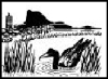
image to enlarge - Magpie geese at Bald Rock, Town Common
Other Wetland Types
The
TTSP also identified six drying coral reefs (Middle Reef, Nobby
Head-West Point reef, Nelly Bay reefs; Geoffrey Bay reef; Alma Bay-Arthur
Bay Reefs, and Liver Point Reef). All occur around Magnetic Island
and are important conservation areas because inshore coral reefs
are under threat from human pressure world wide.
The
coast and marine waters off Townsville in Cleveland Bay also retain
significant seagrass beds and the bay is a designated Dugong Protection
Sanctuary under Queensland legislation. The largest areas of seagrass
are found on the eastern side of Cleveland Bay (8,400 hectares)
and Cape Pallarenda, south-west side of Magnetic Island (3,000 hectares).
Click
here to See Marine and Intertidal
Habitat map
(source
"Planning to Protect Biodiversity" Environment North 2002,
and citing Lee Long et al. 1998)
Visit
the Great
Barrier Reef Explorer
Key Habitat Areas and Refuges
Finally
there are highly significant habitats in the Townsville area which
are either important areas for populations of certain species, and/or
are habitats which support a high diversity of species. There is
a little data on many species distributions in the Townsville region
(especially mammals e.g. Dasyurus hallucatus or Northern Quoll which
is of regional significance). Mt. Stuart is a known area of marsupial
diversity (CB Consulting Group 1997). The Allied Rock-Wallaby (Petrogale
assimilis) a species found in a narrow band from Palm Island/Magnetic
Island/Many Peaks/Mt. Stuart/Cape Cleveland/Mt. Elliot and out west
is considered regionally significant.
Refuge
areas are special types of habitat which provide safe haven for
wildlife during periodic adverse conditions. In Townsville there
are a number of regionally significant refuge areas, including;
- Riparian
refuges along major rivers (e.g. Ross River, Stuart Creek);
- Wetland
refuges of the Townsville area such as the Town Common;
- Vine
forest refuges (especially Mt. Stuart); and
- Montane
refuges of Mt. Elliot for rainforest species.
Click
here for Key
Habitat Areas map, and
Click
here for Refuge
Areas map
Source:
TCC Report Planning For Biodiversity, Environment North 2002
National Estate Listings
Townsville
also has a number of environmental sites of national significance.
These include National Parks, Conservation Parks and other sites
listed on the Register of the National Estate (RNE). These are
listed in the following table:
| Place
Name |
Legal
Status |
| Cape
Cleveland National Park, Townsville |
Registered
|
| Horseshoe
Bay Lagoon Environmental Park, Magnetic Island |
Registered
|
| Magnetic
Island (in Part), Magnetic Island |
Registered
|
| Mount
Burrumbush National Park, Townsville |
Registered
|
| Mount
Elliot National Park, Townsville |
Registered
|
| Townsville
Town Common and Environs, Townsville |
Registered
|
| Serpentine
Lagoon, Woodstock |
Registered
|
(Note:
The declaration of the Bowling Green National Park covers areas
that were once Cape Cleveland National Park and Mount Burrumbush
National Park).
Click
here for
Register
of the National Estate and Queensland Heritage Register Areas
map
Source:
TCC Report Planning For Biodiversity, Environment North 2002
Wilderness Areas
There
are two areas in Townsville LGA which are believed to qualify for
wilderness status (one of national significance and one regional
significance).
-
High
Range Wilderness Area (80,600 hectares) the eastern end of which
includes Mt. Flagstone State Forest, and
-
Mt.
Elliot Potential Wilderness Area (30,868 hectares) - limited
because powerlines dissect the area.
Click
here for Wilderness
Areas map.
Source:
TCC Report Planning For Biodiversity, Environment North 2002

Vine
and berries of the monsoon thicket
Introduced Pest Flora and Fauna
In
Townsville, 66 plant species are known to be environmental weeds
and at least fifteen species are considered to be a severe problem
locally (TCC Draft Pest Management Plan and TCC Revegetation Strategy).
Of these, twelve are declared under State legislation, which means
that individual landholders must take control measures (Community
Plan for Natural Resource Management and Environmental Conservation
in the Townsville-Thuringowa Coastal Plains, TThLCA Inc. 2000).
Council
also has responsibility for control of declared plants within its
LGA (Section 64 of the Rural Lands Protection Act 1985) and exercises
this responsibility.
Go
to Top |