![]()
|
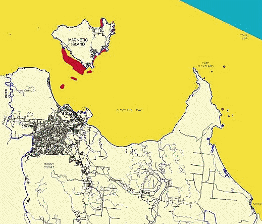
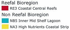
Marine
Bioregions adjacent to
Townsville Local Government Area. |
|
 |
|
 |
 |
|
Click
here for brochure detailing bioregions MetaData
for GBRMPA GIS datasets |
|
|
Category |
Detail/Comment |
|
|
Dataset |
Title |
Reefbio_outlines |
|
Custodian |
Great Barrier Reef Marine Park Authority |
|
|
Jurisdiction |
Queensland, Australia |
|
|
Description |
Abstract |
Bounding polygons for reef bioregions. This shapefile is intended for use as a backdrop to reef bioregions to more clearly define their extents. |
|
Search Words |
Reefs, Great Barrier Reef, Reef Habitat, Reef Bioregions |
|
|
Geographic Extent |
Great Barrier Reef World Heritage Area; East Coastal Queensland; Continental Shelf Area within 142E 10 24S and 151E 24 30S |
|
|
Currency |
Origin Date |
Classification of bioregions began Jan 1999 |
|
Ending Date |
Bioregions adjusted to implement advice from stakeholders and reef and non-reef experts March 2001. Bounding polygons for reef bioregions created November 2001. |
|
|
Status |
Progress |
All positional boundary changes finalised |
|
Projection |
Unprojected Geographic coordinates |
|
|
Datum |
GDA94 |
|
|
Scale |
nominal 1:250,000 |
|
|
Maintenance, Update Frequency |
Bioregions are to be updated every 5 years as more information becomes available. Bounding polygons will be updated as required. |
|
|
Stored Data Format |
Digital ARC/INFO shapefile |
|
|
Available Format Type |
Digital ARC/INFO shapefile |
|
|
Access Contraint |
Completion of GBRMPA Digital Data Agreement. |
|
|
Quality |
Lineage |
Reef bioregions: See Technical Report on the Classification Phase of the Representative Areas Program by Kerrigan, Breen et al, 1999 (in progress) Bounding polygons: Thiessen polygons were constructed for all reefs, and then dissolved by bioregion. Reefs were buffered by 10 km, overlayed with the Thiessen coverage, and then dissolved by bioregion again. |
|
Positional Accuracy |
Generally +- 125 metres, as it relies partly on locational accuracy of other base GBRMPA datasets, namely REEFS, ISLANDS, COAST. |
|
|
Attribute Accuracy |
Attribute bioregion came from nonreefbioregion in the non-reef coverage and reefbioregion in the reef coverage. Field bioregion relates to the unique id field (bioregion) in the lookup table bioregion.lut. The values correspond to the reefbioregion and nonreefbioregion attributes of the separate datasets. Final reef bioregion names are stored in the look up table in the field short_desc. Field Label is the short version of the final short_desc field for the purpose of processing |
|
|
Logical Consistency |
WHA boundary coincides with COAST, parts of GBRMP ZONING, GBRMP and WHAGBR. Reef bioregions are logically consistent with the REEFS coverage. |
|
|
Completeness |
The bioregions of the Great Barrier Reef World Heritage Area evolve as more accurate data becomes available. |
|
|
Contact Information |
Organisation |
Great Barrier Reef Marine Park Authority |
|
Position |
Geographic Information Systems Manager |
|
|
Address |
2 - 68 Flinders Street |
|
|
Mail Address |
P.O. Box 1379 |
|
|
Locality |
Townsville |
|
|
State |
Queensland |
|
|
Country |
Australia |
|
|
Postcode |
Qld 4810 |
|
|
Telephone |
(07) 4750 0700 |
|
|
Facsimile |
(07) 4772 6093 |
|
|
|
gis@gbrmpa.gov.au |
|
|
Metadata |
Metadata Date |
26-11-2001 |
|
Additional Metadata |
Technical Report on the Classification Phase of the Representative Areas Program - Kerrigan, Breen et al, 1999 (in progress). The Representative Areas Program for Protecting Biodiversity In the Great Barrier Reef World Heritage Area Day, Fernandes et al, 2001 (in press) |