| Layer Metadata |  |
|
Metadata for Great Barrier Reef Marine Park Zones - GBRMPA
| Data Set | ||
| DSIN | 10258 | |
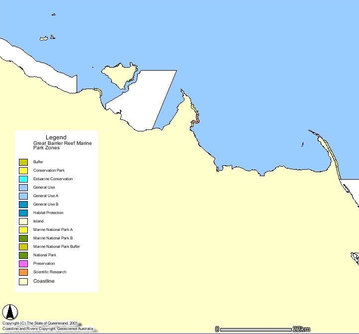
| Title | Great Barrier Reef Marine Park Zones - GBRMP | |
| Custodian | Great Barrier Reef Marine Park Authority | |
| Jurisdiction | Great Barrier Reef | |
| Description | ||
| Abstract | Federal Marine Park Zones within the Great Barrier Reef Marine Park. | |
| Search Word(s) | Management | |
| Geographic Extent Name(s) | Great Barrier Reef | |
| Coordinates | N: -10.6 | |
| S: -24.5 | ||
| E: 154 | ||
| W: 142.5 | ||
| Data Currency | ||
| Beginning date | 1/01/1984 | |
| Ending date | 24/07/2001 | |
| Dataset Status | ||
| Progress | Complete | |
| Maintenance and update frequency | As required | |
| Access | ||
| Stored Data Format | DIGITAL - ARC/INFO, DIGITAL - ArcView | |
| Available Format Type | DIGITAL - ARC/INFO, DIGITAL - ArcView | |
| Access Constraint | QFS Use Only, not for release outside QFS | |
| Data Quality | ||
| Lineage | Derived from gazetted descriptions, and in part from references to datasets produced by the Division of National Mapping, RAN Hydrographic Service. Boundary was updated on 07/06/2000 in line with the inclusion of twelve previously excluded areas into the marine park. The following 12 areas gazetted 2 August 2000: A. Sharp Point to Sadd Point = Shadwell Section B. Captain Billy Landing = Heathlands Section C. Margaret Bay = Margaret Bay Section D. South of Cape Grenville = Indian Bay Section E. 1st Stony Point = Fair Cape Section F. Bobardt Point = Night Island Section G. Port Stewart = Claremont Section H. Barrow Point = Ninian Bay Section I. Mission Beach = Mission Beach Section J. Burdekin = Burdekin Section K. Western Repulse Bay = Repulse Bay Section L. Bustard Head to Rocky Point = Bustard Bay Section Coverage updated 17.01.01 to reflect these 6 new areas: The following areas gazetted 13 December 2000: A. Bathurst Head = Bathurst Head Section B. Portland Roads = Weymouth Section The following areas gazetted 22 December 2000: A. Cooktown = Cooktown Section B. Clump Point = Clump Point Section C. Broad Sound = Sroad Sound Section D. Connor Bluff to North Point = Curtis Island Section | |
| Positional Accuracy | Vaier from 1-125 metres, as it relies partly on locational accuracy of other base GBRMPA datasets, namely ZONING, ISLANDS, COAST. Lines depicted in coverage are an interpretation of gazzetted descriptions published in the GBRMPA zoning plans and should always be used in conjuction with these descriptions to avoid possible error. | |
| Attribute Accuracy | Contains complementary 'Zone' and 'Zone_No' attributes which refer to specific allowable activities. Names and codes updated as required when zoning and / or rezoning plans are finalized. Zoneing.avl and Zoning.shd are provided with this data and are to be used in ArcView and ArcInfo to shade the zones on the 'Zone_No' attribute. | |
| Logical Consistency | 'Zone' and 'Zone_Id' attributes are complementary, but vary among the major 4 Marine Park sections, they do however represent identical allowable activities and restrictions. | |
| Completeness | All gazetted/current Great Barrier Reef Marine Park Sections are represented. Future Marine Park additions and Section modifications will necessitate dataset updates. | |
| Contact Information | ||
| Contact Organisation | Great Barrier Reef Marine Park Authority | |
| Contact Position | Geographical Information Systems Manager | |
| Mail Address | 2 - 68 Flinders Street, PO Box 1379 | |
| Locality | Townsville | |
| State | Qld | |
| Country | Australia | |
| Postcode | ||
| Telephone | 4750 0700 | |
| Facsimile | 4772 6093 | |
| Electronic Mail | gis@gbrmpa.gov.au | |
| Metadata Date | ||
| Creation Date | 21/06/2000 | |