| Layer Metadata |  |
|
Metadata for Dugong Protection Areas
| Data Set | ||
| DSIN | 10327 | |
| Title | Dugong Protection Areas | |
| Custodian | Queensland Fisheries Service - Assessment & Monitoring Unit | |
| Jurisdiction | QLD | |
| Description | ||
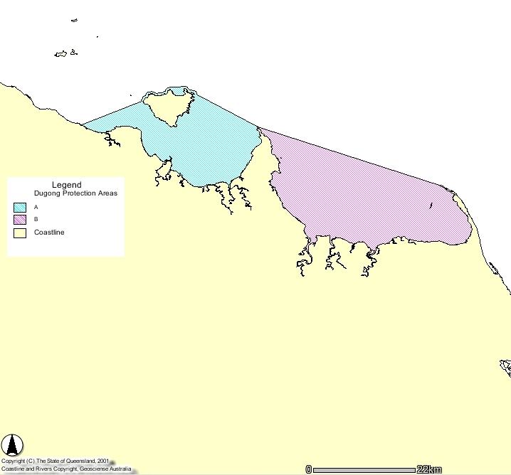
| Abstract | On the 14th August 1997 the Federal and Queensland Governments announced measures to save dugongs in the southern Great Barrier Reef and Hervey Bay regions. Central to these measures was the establishment of a system of dugong protection areas in these regions. The Areas are declared in legislation under the Fisheries Act 1994 and the Queensland Nature Conservation Act 1992. Two types of protection areas were established : Zone A has more stringent controls over netting practices. Foreshore set nets and offshore set and drift nets are prohibited in most Zone A protection areas. In Zone B mesh netting is permitted but with restrictions on the type, size and location of nets, and requirements for attendance at nets. | |
| Search Word(s) | Ecology, Habitat | |
| Geographic Extent Name(s) | Queensland East Coast | |
| Coordinates | N: -9 | |
| S: -29.5 | ||
| E: 154 | ||
| W: 138 | ||
| Data Currency | ||
| Beginning date | 1/01/1997 | |
| Ending date | 1/11/2001 | |
| Dataset Status | ||
| Progress | Complete | |
| Maintenance and update frequency | As required | |
| Access | ||
| Stored Data Format | DIGITAL - ARC/INFO, DIGITAL - ARC/INFO Export | |
| Available Format Type | DIGITAL - ARC/INFO, DIGITAL - ARC/INFO Export | |
| Access Constraint | QFS data - release outside QFS on completion of a data agreement | |
| Data Quality | ||
| Lineage | Engineered in AGD66 datum, the coastline is taken from the Austalian Land Information Group 1:100,000 coastline. The lineage is taken from the description of the dugong protection area as specified in the latest gazette of the Fisheries Regulations 1995. | |
| Positional Accuracy | The positional accuracy is regarded as being the positional accuracy of the Australian Land Information Group 1:100,000 coastline data. This is estimated at being accurate to 150m. | |
| Attribute Accuracy | Contains ‘DPA_Name’ and ‘DPA_Type’ attributes which refer to specific activity restrictions. Attribute contents have been validated. Attributes: [dpa_name] = name of dpa, [dpa_type] = code defining type of dpa, [x-coord], [y-coord] | |
| Logical Consistency | The dataset is regarded as logically consistent. | |
| Completeness | All gazetted Dugong Protection Areas are represented, and dataset is regarded as complete. | |
| Contact Information | ||
| Contact Organisation | Queensland Fisheries Service - Assessment & Monitoring Unit | |
| Contact Position | Fish Data Coordinator | |
| Mail Address | Level 2 80 Ann Street | |
| Locality | Brisbane | |
| State | Qld | |
| Country | Australia | |
| Postcode | 4001 | |
| Telephone | 07 3405 6822 | |
| Facsimile | 07 3224 2805 | |
| Electronic Mail | FishDataCoordinator@dpi.qld.gov.au | |
| Metadata Date | ||
| Creation Date | 21/06/2000 | |