| Layer Metadata |  |
|
Metadata for National Public and Aboriginal Lands
| Data Set | ||
| DSIN | 10083 | |
| Title | National Public and Aboriginal Lands | |
| Custodian | Torres Strait Regional Authority | |
| Jurisdiction | QLD | |
| Description | ||
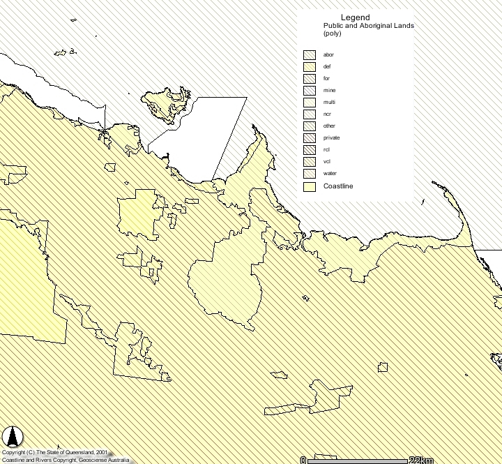
| Abstract | Contains boundary and attribute information for parcels of public, Aboriginal and Torres Strait Islander land in Australia which are greater than 40 hectares. Selected smaller areas are shown by point locations (includes nature reserves, forests and Aboriginal land). Categories: abor - aboriginal land, includes crown reserves, freehold and leasehold coastline - boundary between land and sea at level of mean high water. The line follows the main outline of the land and the seaward edge of mangroves def - defence land, reserved for the use by the armed forces for - crown land managed and controlled by state forestry services mine - crown lands held in reserve for mining multi - areas where there is more than one controlling authority ncr - areas reserved by an Act or Resolution of Parliament for the purposes of protecting the natural environment. Ocean - areas of ocean that are enclosed between the coastline and declared marine features other - areas reserved for educational, scientific or other activities of public interest private - privately owned land undifferentiated by tenure, excluding areas held by aboriginal communities public - edge of land allocation rcl - crown lands reserved for any other purpose than specified with other feature codes or being held in reserve pending dedication river - line closing the coastline across the river mouth state - unattributed line feature delineating state borders vcl - areas of crown land that are not reserved for any purpose water - areas of crown land that are reserved to protect water supplies Attribute information includes (as applicable to the type of reserve): State and reserve name; reserve type; administering authority; size (in hectares); identification number; and dates of original proclamation and latest update. NOTE: Data have not been verified by State authorities. | |
| Search Word(s) | Reserves | |
| Geographic Extent Name(s) | Australia | |
| Coordinates | N: -9 | |
| S: -29 | ||
| E: 154 | ||
| W: 137 | ||
| Data Currency | ||
| Beginning date | 1/06/1985 | |
| Ending date | 1/01/1992 | |
| Dataset Status | ||
| Progress | Complete | |
| Maintenance and update frequency | Unknown | |
| Access | ||
| Stored Data Format | DIGITAL - ARC/INFO, DIGITAL - ARC/INFO Export | |
| Available Format Type | DIGITAL - ARC/INFO, DIGITAL - ARC/INFO Export | |
| Access Constraint | QFS Use Only, not for release outside QFS | |
| Data Quality | ||
| Lineage | NOTE: Data have not been verified by State authorities. Data were collected primarily for national 1:250 000 scale mapping purposes. Source information for key land tenure classes (including forestry, nature conservation and Aboriginal lands) have been extracted from State and Commonwealth Government gazettes. Declared areas and boundary changes are recorded from gazettals and data holdings are periodically verified by comparison with information obtained from relevant State authorities. The Commonwealth Aboriginal and Torres Strait Islander Commission and State government departments have provided information on Aboriginal-held lands which are not gazetted. Information relating to institutional, mining and other classes was obtained from published maps but has not been systematically collected and contains little attribute information. Public roads and smaller reserves in urban areas are specifically excluded. The remaining areas are largely freehold land or leasehold Crown lands and are not distinguished. State borders were derived from survey details and coordinates were directly digitised. Sate borders following stream lines were digitised from 1:25 000, 1:50 000 and 1:100 000 scale topographic maps. The coastline for the database was redrawn from the 1:250 000 scale NTMS series and digitised along with parcel boundaries for each sheet. First cover data was acquired primarily from a previous database maintained in AUSLIG through gazettal information. Boundary information was stored on cadastral map sets and individual reserve plans. Boundary information is also regularly supplied by the refluent State authorities in the form of plans, diagrams, dyelines etc. The boundaries were transferred to 1:250 000 overlays by optical and photographic reduction. Overlays were checked against original sources, corrections made, and were either hand digitised or scanned depending upon the amount of detail in the line network. BR> Attribute information such as name, type of reserve, area, authority, reserve number, and proclamation date was entered into the attribute table. A unique identification number, source material and the date of data entry were added for internal database for maintenance purposes. | |
| Positional Accuracy | Not Documented | |
| Attribute Accuracy | Appendix A to the National Public and Aboriginal Lands Data User Guide, supplied with the data, describes each feature in the database. It lists the feature code, definition, mandatory attributes and then lists valid attribute values for particular items. For a given feature code, all attributes listed as mandatory are populated. Entries in other fields depend on source/gazettal availability. Appendix B to the National Public and Aboriginal Lands Data User Guide, defines each valid attribute value for the type of reserve (B.1), state code (B.2) and controlling authority (B.3). An exhaustive check of each State database has been completed to ensure that only valid features and attributes are supplied. Oracle query tests carried out include: check of valid feature codes; removal of invalid and system feature codes; check for all polygon and point features attached to attribute tables; tally of all polygons, points and attribute table records; check of layer/network assignment of all features; and cross-check for invalid feature code/type combinations. | |
| Logical Consistency | The logical consistency of the database is defined by validating attributes, topological structure and graphical inconsistency clauses. All mandatory attributes for all features contain an entry. The topological structure is fully complete. There are no duplicate lines, no overshoots or undershoots in the database. | |
| Completeness | State and Commonwealth gazettes provide information on proclamations and additions to Crown reserves. Completeness is checked through periodic comparison against State authority estate listings for nature conservation reserves, forestry reserves and Aboriginal reserves. Information on other Aboriginal lands is obtained through liaison with ATSIC offices and State Land Departments. Data is collected on a state basis and the completeness and currency of data is summarised below. Reserve Type NSW NT QLD SA TAS VIC WA NCR JUN1997 SEP1991 SEP1990 DEC1990 APR1991 APR1991 JUN1990 Forest JUN1997 N/A MAR1991 DEC1990 APR1991 APR1991 JUN1990 Aboriginal JUN1997 SEP1991 SEP1990 DEC1990 APR1991 APR1991 JUN1990 Water JUN1997 MAR1991 SEP1987 JUN1986 APR1991 APR1991 JUN1988 Defence JUN1997 MAR1991 SEP1987 JUN1986 APR1991 APR1991 JUN1988 Mining JUN1997 MAR1991 SEP1987 JUN1986 APR1991 APR1991 JUN1988 | |
| Contact Information | ||
| Contact Organisation | Torres Strait Regional Authority | |
| Contact Position | Data Sales Staff | |
| Mail Address | PO Box 2 | |
| Locality | Belconnen | |
| State | ACT | |
| Country | Australia | |
| Postcode | 2616 | |
| Telephone | 02 6201 4340 | |
| Facsimile | 02 6201 4381 | |
| Electronic Mail | ||
| Metadata Date | ||
| Creation Date | 21/06/2000 | |